Arlington County, Virginia
| Arlington County, Virginia | ||
|
||
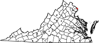 Location in the state of Virginia |
||
 Virginia's location in the U.S. |
||
| Founded | February 27, 1801 | |
|---|---|---|
| Seat | Arlington | |
| Area - Total - Land - Water |
26 sq mi (67 km²) 26 sq mi (67 km²) 0 sq mi (0 km²), 0.35% |
|
| PopulationEst. - (2009) - Density |
209,300 7,995/sq mi (3,087/km²) |
|
| Website | www.arlingtonva.us | |

.jpg)
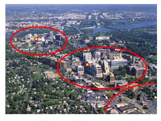
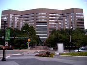
Arlington County is a county containing about 210,000 residents in the Commonwealth of Virginia. It is located directly across the Potomac River from Washington, D.C., and the two of them are linked by several highway and railroad bridges, and a tunnel beneath the river. A major airport of Washington, D.C., Ronald Reagan Washington National Airport, many Federal Government offices, including those of the Department of Defense and the Department of the Navy, and Arlington National Cemetery are located in Arlington County.[1]
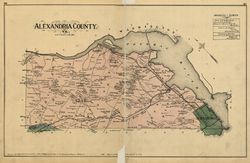
The county was originally founded as Alexandria County on February 27, 1801 by passage of the District of Columbia Organic Act of 1801. Alexandria County along with the now-defunct Washington County were the two counties formed on that date within the District of Columbia. Due to issues involving congressional representation, abolition and economic decline, the county along with the then-Town of Alexandria were returned to the Commonwealth of Virginia in an act of the U.S. Congress which took effect in 1847. In 1920 the General Assembly of Virginia changed the name of the county to "Arlington County" in order to avoid confusion with Alexandria, which had become an independent city in 1870.
Arlington County is organized legally as one of the counties of Virginia. For purely statistical considerations, it is included with the nearby cities and counties as a city of the Washington Metropolitan Area by the U.S. Census Bureau. With a land area of 26 square miles (67 km2), Arlington County is geographically the smallest self-governing county in the United States.[2]
In 2005, Arlington was ranked first among walkable cities in the United States by the American Podiatric Medical Association.[3] CNN Money ranked Arlington as the most educated city in 2006 with 35.7% of residents having held graduate degrees. Along with five other counties in Northern Virginia, Arlington ranked among the twenty American counties with the highest median household income in 2006.[4] In October 2008, BusinessWeek ranked Arlington as the safest city in which to weather a recession, with a 49.4% share of jobs in "strong industries".[5] In July 2009, CNN Money ranked Arlington second in the country in its listing of "Best Places for the Rich and Single."[6] In June 2010, Parenting magazine named Arlington as the "Best City for Families" in the country.[7]
Arlington is the location of the Arlington National Cemetery, the Washington National Airport, The Pentagon (of the U.S. Department of Defense), Fort Myer (of the U.S. Army), the Pentagon Memorial, the U.S. Marine Corps Memorial, and the U.S. Air Force Memorial.
Contents |
History
Colonial-era land grants, sources of names
Arlington County was within the very large area defined in several early British land grants in the colonial period in the Colony of Virginia (1607–1776) which was known as the Northern Neck of Virginia (not to be confused with a smaller eastern portion of Virginia still known by that name in modern times).
Land grants, generally to prominent Englishmen, were various combinations of political favors and efforts at development. Perhaps the best known of the grantees was Thomas Fairfax, 6th Lord Fairfax of Cameron (Lord Fairfax), whose name is seen in many places in what is now known as Northern Virginia, notably Fairfax County and the independent city of Fairfax. Also notable among the land grants was one in 1673 from King Charles II to Thomas Colepeper, 2nd Baron Colepeper and Henry Bennet, 1st Earl of Arlington (the Earl of Arlington) whose names eventually were applied to several community features, and were the original source of the naming of Culpeper County and Arlington County. The County's oldest surviving structure is the Moses Ball log house located in the Glencarlyn neighborhood.
The current Arlington County as it is now known in Virginia was the result of a renaming in 1920. The name of the 17th-century Earl of Arlington had been applied much earlier to a plantation on Virginia's eastern Shore, for which another plantation on the Potomac River was named. Much of the Potomac River plantation became Arlington National Cemetery as a result of its seizure from Robert E. Lee's family during the War Between the States.
Boundaries and jurisdictions
Once part of Fairfax County in the Colony of Virginia, the area that contains Arlington County was ceded to the new U.S. government by the Commonwealth of Virginia. In 1791, the U.S. Congress formally established the limits of the federal territory that would be the nation's capital as a square of 10 miles (16 km) on a side, the maximum area permitted by Article I, Section 8, of the United States Constitution. However, the legislation (an amendment to the Residence Act of 1790) that established these limits specifically prohibited the "erection of the public buildings otherwise than on the Maryland side of the River Potomac.[8]
During 1791 and 1792, Andrew Ellicott led a team of surveyors that determined the boundaries of the federal territory. The team placed along the boundaries forty markers that were approximately one mile from each other. Fourteen of these markers were in Virginia. Many of these still remain standing.[9][10]
When the Congress moved to the new District of Columbia in 1801, it enacted legislation (the District of Columbia Organic Act of 1801) that divided the District into two counties: (1) the "County of Washington", which was located on the northern side of the Potomac River, and (2) the "County of Alexandria", which lay on the southern side of the Potomac.[11] Alexandria County contained the present area of Arlington County, then mostly rural, and the settled town of Alexandria (now "Old Town" Alexandria), a seaport located on the Potomac River in the southeastern part of the area of the present-day Independents City of Alexandria.
Residents of Alexandria County had expected the federal capital's location would result in land sales and the growth of commerce. Instead the county found itself struggling to compete with the town of Georgetown, a port located in Washington County adjacent to the capital city (Washington City).
Since, by Act of Congress, the Federal Government could not establish any offices in Alexandria County, and since the economically-important Chesapeake and Ohio Canal (the "C&O Canal") on the northern side of the Potomac River favored the town of Georgetown, Alexandria's economy stagnated. It did not help the southern count that some Georgetown residents opposed the Federal Government's efforts to maintain the "Alexandria Canal", which connected the C&O Canal in Georgetown with the seaport of Alexandria. In addition, as residents of the District of Columbia, the residents of Alexandria County had neither representation in the U.S. Congress, nor any vote in any Federal or State elections - not even in Presidential elections, where the ability to do so by the residents of the District was added by a Constitutional Amendment during the 20th Century.
The town of Alexandria had been both a port and an auction market for the slave trade for Maryland and Virginia. With growing pressure for the abolition of slavery in the national Capital City, some people of Alexandria feared that the local economy would suffer if the Federal government carried out this abolition. At the same time, an active abolition movement arose in Virginia that created a division on the question of slavery in the Virginia General Assembly. (Later on, during the War Between the States, this division on the question of slavery in Virginia led to the formation of the State of West Virginia by the most anti-slavery section of the state, the 61 counties in the northwest). Pro-slavery Virginians recognized that Alexandria County could provide two new representatives who favored slavery in that State's General Assembly if this County were returned to the Commonwealth.
Largely as a result of these factors, a movement grew to separate Alexandria County from the District of Columbia. After a referendum, the county's residents petitioned the U.S. Congress and the Virginia legislature to permit the County to return to Virginia. The area was retroceded to Virginia on July 9, 1846.[12]
In 1852, the independent city of Alexandria was incorporated from a portion of Alexandria County.[13] This led to occasional confusion, as the adjacent county and city continued to share the name of "Alexandria". In 1920, the Virginia General Assembly renamed Alexandria County as "Arlington County", to honor Robert E. Lee and to end the ongoing confusion between Alexandria County and the independent city of Alexandria.
Civil War
During the American Civil War, though Virginia was part of the Confederacy, that country's control did not usually extend to Northern Virginia and Arlington County. The Federal Congress passed a law in 1862 that those districts in which the "insurrection" persisted were to pay their real estate taxes "in person." The property of Robert E. Lee at Custis-Lee Mansion was subjected to an appraisal of $26,810 on which a tax of $92.07 was assessed. The Lees could not pay this in person as they would be subject to arrest. It became confiscated by the Federal government as a result. After the war, and after the deaths of the Lees, (Robert E. Lee died in 1870.) the U.S. Supreme Court found that this had been unconstitutional. The Federal Government paid their heirs $150,000 for the value of the property.[14]. Today, the Arlington House is a Federally-maintained historic site.
Virginia seceded from the Union as a result of a statewide referendum held on May 23, 1861. The voters from Alexandria County, as it was then known, joined the state at large in directing Virginia’s secession by a vote of 958-48. This vote indicates the degree to which its only town, Alexandria (not yet an independent city), was pro-secession and pro-Confederate. The Union loyalists who lived in rural areas outside the town of Alexandria, rejected secession.[15]
The voting in Alexandria County was marred by the physical intimidation of presumed Northern loyalists at the polls by their pro-Confederate neighbors. Smith Minor, an elderly man living between Ball’s Crossroads (modern Ballston) and Falls Church, was pressured by armed men belonging to Virginia’s Rappahannock Cavalry and Ball’s Fairfax Cavalry to switch his intended vote and vote for Virginia’s secession. He did so, fearing for his life. [16]
Confederate incursions from Falls Church, Minor’s Hill and Upton’s Hill—-then securely in Confederate hands—-occurred as far east as modern Ballston. On August 17, 1861 an armed force of 600 Confederates engaged the 23red New York Infantry near that crossroads, killing one. Another large incursion on August 27 involved between 600 and 800 Confederates, which clashed with Union soldiers at Ball’s Crossroads, Hall’s Hill and along the modern-day Falls Church-Arlington border. A number of soldiers on both sides were killed. [17]
At Ball’s Crossroads at this time the Confederate Army also perfected what it called the “Cow-Bell Dodge” – concealing themselves in the woods near Union Army scout patrols, called pickets, they would begin the irregular tinkle of a cow-bell. As a soldier at the time put it, “The uninitiated picket, not suspecting the ruse, and not yet reconciled to drinking his coffee without milk, goes out to obtain a supply from the supposed cow of some Virginia rebel…” At least twelve Union pickets were captured in this way. [18]
The "Lost" Town of Potomac
The incorporated town of Potomac (in existence 1908 – 30) was located in Arlington County. However, it was annexed by the adjacent independent city of Alexandria in the year 1930, and thus, it joined the list of the lost towns of Virginia.
Although vanished as a political subdivision, the former town of Potomac is now a historic district within Alexandria, and it covers 1,840 acres and 690 buildings. The Town of Potomac was added to the National Register of Historic Places in 1992.
Several other areas within the independent city of Alexandria (besides Potomac) have been annexed into that city from either Arlington County or Fairfax County over the decades since the present government of Alexandria was established. However, all of current Arlington County had once been part of the District of Columbia, and is all in Virginia now. Therefore, Arlington is the only county in Virginia that has both left and rejoined the Commonwealth of Virginia.
From a certain point-of-view, Arlington County and Alexandria have also both departed from, and then re-entered, the United States of America.
20th century and beyond
In 1896 an electric trolley line was built from Washington through Ballston. In the 1930s Hoover Field Airport was established on the present site of the Pentagon; in that decade, Buckingham, Colonial Heights, and other apartment communities also opened. World War II brought a boom to the county, but one that could not be met by new construction due to rationing imposed by the war effort. In October 1942, not a single rental unit was available in the county.[19] The Henry G. Shirley Highway (now Interstate 395) was constructed during WWII, along with adjacent developments such as Shirlington, Fairlington, and Parkfairfax.
US Airways (formerly USAir) maintained its corporate headquarters in Arlington.[20] When it merged with America West Airlines, the headquarters moved out of the county.[21]
The attacks of 9/11 killed 125 people at the Pentagon.
A blizzard in early 2010 was soon followed by another which resulted in the shutdown of schools and work for over a week in 2010. Encumbered by up to an accumulated 18 inches of snow, emergency routes were cleared after 24 hours. It took up to two weeks to restore usability to the remainder of streets and sidewalks.[22][23] A snow removal ordinance was subsequently passed. None had been considered necessary before.[24]
Geography


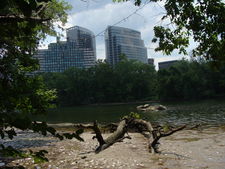
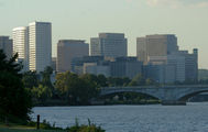
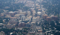
Arlington County is surrounded by Fairfax County on the north, west and south. It is located at [25]. It is adjacent along its southwest and southern borders to the City of Falls Church and the City of Alexandria; and along the Potomac River north.[26] Included in the county are several neighborhoods, or "urban villages" such as Crystal City, Rosslyn, Ballston, Clarendon, Virginia Square, Westover, and Shirlington.[27]
According to the U.S. Census Bureau, the county has a total area of 26 square miles (67 km²), of which about 4.6 square miles (12 km²) is federal property. The county is roughly in the shape of a rectangle 4 miles (6.4 km) by 6 miles (9.7 km), with the small end slanting in a northwest-southeast direction. As of January 1, 2008, the estimated population was 209,969,[1] giving the county a population density of approximately 7,995 persons per square mile. All cities within the Commonwealth of Virginia are independent of counties, though towns may be incorporated within counties. Considering this, it is inaccurate to refer to Arlington County as a city. However, Arlington has no existing incorporated towns because Virginia law prevents the creation of any new municipality within a county that has a population density greater than 1,000 persons per square mile. Its county seat is the census-designated place (CDP) of Arlington[28], which is coincident with the Census Boundary of Arlington County; however, the county courthouse and most governmental offices are located in the Courthouse neighborhood.
The county is entirely Inside the Beltway, the I-495 turnpike that girds the Washington, DC area, and is the only county to hold that distinction.
Geographically, the county is bordered on the north and east by the Potomac River. Other landforms also form county borders, particularly Minor's Hill and Upton's Hill on the west, which form its borders with Fairfax County and the City of Falls Church.
Neighborhoods
There are numerous unincorporated neighborhoods within Arlington County that are commonly referred to by name as if they were distinct towns. The county characterizes some of these neighborhoods - particularly those located at Metrorail stations and other major transportation corridors - as "urban villages." These are usually centers with commercial activity. These include:
|
|
|
|
There are also numerous neighborhoods which are largely residential including:
|
|
|
|
|
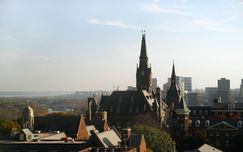
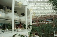
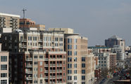
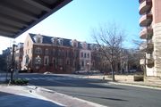
Arlington County includes a large selection of Sears Catalog Homes, which were offered between 1908 and 1940, Considered to be of exceptional quality, in modern times, these houses are sought after by many home buyers. As well, Arlington features some of the first and among the best examples of post-World War II garden style apartment complexes in the U.S., some of which were designed by architect Mihran Mesrobian. Arlington Boulevard (Route 50) is the dividing line in the county.
"Smart Growth" Development Patterns
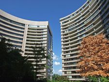
Arlington has won awards for its smart growth development strategies.[29] For over 30 years, the government has had a policy of concentrating much of its new development near transit facilities, such as Metrorail stations and the high-volume bus lines of Columbia Pike.[30] Within the transit areas, the government has a policy of encouraging mixed-use and pedestrian- and transit-oriented development.[31] Outside of those areas, the government usually limits density increases, but makes exceptions for larger projects that are near major highways, such as in Shirlington, near I-395 (the Shirley Highway).[32]
Much of Arlington's development in the last generation has been concentrated around 7 of the County's 11 Metrorail stations.[33]
In addition, the County implemented in 2005 an affordable housing ordinance that requires most developers to contribute significant affordable housing resources, either in units or through a cash contribution, in order to obtain the highest allowable amounts of increased building density in new development projects, most of which are planned near Metrorail station areas.[34]
PRAT[35] maintains detailed data about current and historical development in Arlington County.[36]
Neighborhood Historic Preservation Districts
A number of the county's residential neighborhoods and larger garden-style apartment complexes are listed in the National Register of Historic Places and/or designated under the County government's zoning ordinance as local Historic Preservation Districts.[37][38]
These include Arlington Village, Arlington Forest, Ashton Heights, Buckingham, Cherrydale, Claremont, Colonial Village, Fairlington, Lyon Park, Lyon Village, Maywood, Penrose, Waverly Hills and Westover.[39][40]
Neighborhood Conservation Plans
Many of Arlington County's neighborhoods participate in the Arlington County government's Neighborhood Conservation Program (NCP).[41] Each of these neighborhoods has a Neighborhood Conservation Plan that describes the neighborhood's characteristics, history and recommendations for capital improvement projects that the County government funds through the NCP.[42]
Postal areas
The U.S. Postal Service's Zip Codes with their first three digits being 222 are all located in Arlington County, and nowhere else. The usual mail delivery areas north of Arlington Boulevard have odd-numbered Zip Codes (22201, 22203,..., 22213), whereas all of the usual delivery areas south of Arlington Boulevard have even-numbered Zip Codes (22202, 22204, 22206). These rules are not necessarily in force for the Zip Codes that have been assigned to Post Office boxes, mass mailers, and military posts, such as at Fort Myer. This is partly because a single post office can have one Zip Code for its usual deliveries, and then one or more additional Zip Codes for Post Office boxes, or for other uses, and the Postal Service wanted these offices to have consecutive numbers.
The Washington National Airport and The Pentagon, both of which are within Arlington County, have been assigned Zip Codes corresponding to Washington, D.C., which begin with the two digits 20.
Fauna
Wildlife in Arlington County includes deer, groundhogs; occasionally foxes and donkeys; rabbits, raccoons, squirrels, turtles, lizards, amphibians, fish, and birds. Among the abundant wild birds present in the entire region containing Arlington County include blackbirds, blue jays, cardinals, cranes, doves; many species of the duck; geese, herons, mockingbirds, pigeons, robins, sea gulls, sparrows, storks, terns, and woodpeckers. There are predatory birds such as falcons, hawks, ospreys, and bald eagles, especially those that prey on fish, amphibians, the pigeon, and the rat.
Arlington is located within the Atlantic Flyway. Migratory birds pass through here on their way north or south. Both land birds and seabirds are present. Sea gulls and pigeons are common.
Seventeen-year cicadas make their periodic appearances.
Demographics
| Historical populations | |||
|---|---|---|---|
| Census | Pop. | %± | |
| 1890 | 4,258 |
|
|
| 1900 | 6,430 | 51.0% | |
| 1910 | 10,231 | 59.1% | |
| 1920 | 16,040 | 56.8% | |
| 1930 | 26,615 | 65.9% | |
| 1940 | 57,040 | 114.3% | |
| 1950 | 135,449 | 137.5% | |
| 1960 | 163,401 | 20.6% | |
| 1970 | 174,284 | 6.7% | |
| 1980 | 152,599 | −12.4% | |
| 1990 | 170,936 | 12.0% | |
| 2000 | 189,453 | 10.8% | |
| Est. 2007 | 204,568 | 8.0% | |
The Arlington County Planning Research and Analysis Team[43] (PRAT) estimates the January 1, 2008 population at 206,800
As of the 2000 census[44], there were:
- 189,453 people
- 86,352 households,
- and 39,290 families residing in Arlington.
The population density was 7,323 people per square mile (2,828/km²), the highest of any county in Virginia.[26] There were 90,426 housing units at an average density of 3,495/sq mi (1,350/km²).
In 2008, the racial makeup of the county was estimated by the US Census to be 80.3% White. This included 15.1% Hispanics or Latinos.[45] Also, 9.35% Black or African American, 0.35% Native American, 8.62% Asian, 0.08% Pacific Islander, 8.33% from other races, and 4.34% from two or more races.
28% of Arlington residents were foreign-born.
There were 86,352 households out of which 19.30% had children under the age of 18 living with them, 35.30% were married couples living together, 7.00% had a female householder with no husband present, and 54.50% were non-families. 40.80% of all households were made up of individuals and 7.30% had someone living alone who was 65 years of age or older. The average household size was 2.15 and the average family size was 2.96.
Families headed by single parents was the lowest in the DC area, under 6%, as estimated by the Census Bureau for the years 2006-2008. For the same years, the percentage of people estimated to be living alone was the third highest in the DC area, at 45%.[46]
In 2009, Arlington was highest in the Washington DC Metropolitan area for percentage of people who were single - 70.9%. 14.3% were married. 14.8% had families. [47]
The age distribution was 16.50% under 18, 10.40% from 18 to 24, 42.40% from 25 to 44, 21.30% from 45 to 64, and 9.40% who were 65 or older. The median age was 34 years. For every 100 females there were 101.50 males. For every 100 females age 18 and over, there were 100.70 males.
In 2009, there were 131,626 active voters in the county.[48]
Population history
- 1960.....163,401[49]
- 1970.....174,284
- 1980.....152,299
- 1990.....170,936
- 2000.....189,453
 Rosslyn |
 Courthouse |
 Ballston |
 Pentagon City |
 Crystal City |
Government
Arlington County is the smallest self-governing county in the United States (the largest county-level jurisdiction being North Slope Borough, Alaska).
The budget for fiscal year 2009 was $1.177 billion.[50]
Arlington is governed by a five person County Board, whose members are elected at-large to staggered four year terms. They appoint a county manager, who is the chief executive of the County Government. Like all Virginia Counties, Arlington also has five elected constitutional officers: a sheriff, a clerk of court, a commonwealth's attorney, a treasurer, and a commissioner of the revenue. Starting in 1996, the County switched from an appointed School Board appointed by the County Board to an elected School Board.
The Metropolitan Washington Airports Authority, which controls Washington DC area airports, has its headquarters on the grounds of Ronald Reagan Washington National Airport in the county.[51]
Elections
In 2009, as the state was voting for the Republican candidate for governor by a 59% to 41% margin, Arlington voted for the Democratic candidate 66% to 34%.[52] Voter turnout was 42.78%.[53]
Starting in 2008, for the first time in many years, all elected officials in Arlington were either nominated by, or, in the case of School Board members, endorsed by the Democratic Party. However, starting in the early 1980s, the Democratic Party was the predominant party in the County. The Republican Party controlled a School Board seat from 1999 until 2007, held a majority on the County Board from 1977 to 1982, and controlled at least one County Board seat until 1995 (and again briefly in 1999).
Arlington is governed or represented by three of the four openly gay elected officials in Virginia. Arlington County Board member Jay Fisette was the first in 1997. Adam Ebbin became the first openly gay Delegate in 2003. In 2006, School Board member Sally Baird became the first openly elected official in Virginia. (The fourth openly gay elected official is Councilman Paul Smedberg of the City of Alexandria Council.)
| Position | Name | Party | First Election | Next Election |
|---|---|---|---|---|
| Chairman | Jay Fisette[54][55] | Democratic Party | 1997 | 2013 |
| Vice-Chairman | Chris Zimmerman[56] | Democratic Party | 1996 | 2010 |
| Member | Mary Hynes[57] | Democratic Party | 2007 | 2011 |
| Member | J. Walter Tejada[58] | Democratic Party | 2003 | 2011 |
| Member | Barbara Favola[59] | Democratic Party | 1997 | 2012 |
Arlington also elects four Members of the 100 Member Virginia House of Delegates and two Members of the Virginia Senate. State Senators are elected to four year terms, while Delegates are elected to two year terms.
| Office | Name | Party and District | First Election | Next Election |
|---|---|---|---|---|
| Senator | Patricia "Patsy" Ticer | Democratic Party (30) | 1995 | 2011 |
| Senator | Mary Margaret Whipple[60] | Democratic Party (31) | 1995 | 2011 |
| Delegate | David Englin[61] | Democratic Party (45) | 2005 | 2011 |
| Delegate | Patrick Hope[62] | Democratic Party (47) | 2009 | 2011 |
| Delegate | Robert Brink[63] | Democratic Party (48) | 1997 | 2011 |
| Delegate | Adam Ebbin[64] | Democratic Party (49) | 2003 | 2011 |
Arlington has an elected five person School Board,[65] whose members are elected to four year terms. Virginia law does not permit political parties to place school board candidates on the ballot, but as in many other Virginia jurisdictions, most Arlington school board candidates run with an explicit party endorsement.
| Position | Name | Party | First Election | Next Election |
|---|---|---|---|---|
| Chair | Sally Baird | endorsed by Democratic Party in 2006 | 2006 | 2010 |
| Vice Chair | Libby Garvey | endorsed by Democratic Party in 2008 | 1996 | 2012 |
| Member | James Lander | endorsed by Democratic Party in 2009 | 2009 | 2013 |
| Member | Abby Raphael | endorsed by Democratic Party in 2007 | 2007 | 2011 |
| Member | Emma Sanchez-Violand | endorsed by Democratic Party in 2008 | 2008 | 2012 |
Arlington also has five Constitutional Officers, all of whom are elected County-wide.
| Position | Name | Party | First Election | Next Election |
|---|---|---|---|---|
| Treasurer | Frank O'Leary[66] | Democratic Party | 1983 | 2011 |
| Clerk of the Court | Paul Ferguson | Democratic Party | 2007 | 2015 |
| Commonwealth's Attorney | Richard "Dick" Trodden[67] | Democratic Party | 1993 | 2011 |
| Sheriff | Beth Arthur[68] | Democratic Party | 2000 | 2011 |
| Commissioner of Revenue | Ingrid Morroy[69] | Democratic Party | 2003 | 2011 |
Presidential election results
Each year's winner in the general election is listed first below.
- 2008 - 71.7% Obama (D), 27.1% McCain (R)
- 2004 - 31.3% Bush (R), 67.6% Kerry (D)
- 2000 - 34.2% Bush (R), 60.1% Gore (D)
- 1996 - 60.5% Clinton (D), 34.6% Dole (R)
- 1992 - 57.8% Clinton (D), 31.9% Bush (R)
- 1988 - 45.4% Bush (R), 53.5% Dukakis (D)
- 1984 - 48.2% Reagan (R), 51.3% Mondale (D)
- 1980 - 46.1% Reagan (R), 39.6% Carter (D)
- 1976 - 50.4% Carter (D), 47.9% Ford (R)
- 1972 - 59.4% Nixon (R), 39% McGovern (D)
- 1968 - 45.9% Nixon (R), 42.6% Humphrey (D)
- 1964 - 61.7% Johnson (D), 37.7% Goldwater (R)
- 1960 - 51.4% Kennedy (D), 48.1% Nixon (R)
Public health and safety
In 2008, 20.3% of the population did not have medical health insurance.[70]
In 2010, AIDS prevalence was 341.5 per 100,000 population. This was eight times the rate of nearby Loudoun County and one-quarter the rate of the District of Columbia.[71]
Crime statistics for 2009 included the report of 2 homicides, 15 forcible rapes, 149 robberies, 145 incidents of or aggravated assault, 319 burglaries, 4,140 incidents of larceny, and 297 reports of vehicle theft. This was a reduction in all categories from the previous year.[72]
Economy
Arlington has consistently had the lowest unemployment rate of any jurisdiction in Virginia.[73] The unemployment rate in Arlington was 4.2% in August 2009.[74] 60% of office space in the Rosslyn-Ballston corridor is leased to government agencies and government contractors.[75]
There were an estimated 205,300 jobs in the county in 2008. About 28.7% of these were with the federal, state or local government; 19.1% technical and professional; 28.9% accommodation, food and other services.[76]
Arlington Economic Development maintains regional economic data and statistics.[77]
Personal income
According to a 2007 estimate, the median income for a household in the county was $94,876, and the median income for a family was $127,179.[78] Males had a median income of $51,011 versus $41,552 for females. The per capita income for the county was $37,706. About 5.00% of families and 7.80% of the population were below the poverty line, including 9.10% of those under age 18 and 7.00% of those age 65 or over.
In 2009, the county was second in the nation for the percentage of people ages 25–34 earning over $100,000 annually (8.82% of the population).[47] [79]
Employment
In October 2009, during the economic downturn, the unemployment in the county reached 4.2%. This was the lowest in the state, which averaged 6.6% for the same time period, and among the lowest in the nation, which averaged 9.5% for the same time.[80]
Real estate
In 2000, the median single family home price was $262,400. About 123 homes were worth $1 million or more. In 2008, the median home was worth $586,200. 4,721 houses, about 10% of all stand-alone homes, were worth $1 million or more.[81]
In 2010, there were 0.9 percent of the homes in foreclosure. This was the lowest rate in the DC area.[82]
Government
Numerous federal agencies are headquartered in Arlington, including the Air Force Office of Scientific Research, DARPA, Drug Enforcement Administration, Foreign Service Institute, National Science Foundation, Office of Naval Research, Transportation Security Administration, United States Department of Defense, United States Fish and Wildlife Service, United States Marshals Service, and the United States Trade and Development Agency.
Companies
Companies headquartered in Arlington include AES Corporation, Alcalde and Fay, CACI, Corporate Executive Board, USA, ESI International, and Rosetta Stone.
Organizations located here include the Consumer Electronics Association, The Politico, and the US-Taiwan Business Council.
Landmarks
Arlington National Cemetery
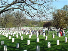
Arlington National Cemetery is an American military cemetery established during the American Civil War on the grounds of Confederate General Robert E. Lee's home, Arlington House (also known as the Custis-Lee Mansion). It is directly across the Potomac River from Washington, D.C., north of the Pentagon. With nearly 300,000 people buried there, Arlington National Cemetery is the second-largest national cemetery in the United States.
Arlington House was named after the Custis family's homestead on Virginia's Eastern Shore. It is associated with the families of Washington, Custis, and Lee. Begun in 1802 and completed in 1817, it was built by George Washington Parke Custis. After his father died, young Custis was raised by his grandmother and her second husband, the first US President George Washington, at Mount Vernon. Custis, a far-sighted agricultural pioneer, painter, playwright, and orator, was interested in perpetuating the memory and principles of George Washington. His house became a "treasury" of Washington heirlooms.
In 1804, Custis married Mary Lee Fitzhugh. Their only child to survive infancy was Mary Anna Randolph Custis, born in 1808. Young Robert E. Lee, whose mother was a cousin of Mrs. Custis, frequently visited Arlington. Two years after graduating from West Point, Lieutenant Lee married Mary Custis at Arlington on June 30, 1831. For 30 years, Arlington House was home to the Lees. They spent much of their married life traveling between U.S. Army duty stations and Arlington, where six of their seven children were born. They shared this home with Mary's parents, the Custis family.
When George Washington Parke Custis died in 1857, he left the Arlington estate to Mrs. Lee for her lifetime and afterwards to the Lees' eldest son, George Washington Custis Lee.
The U.S. government confiscated Arlington House and 200 acres (81 hectares) of ground immediately from the wife of General Robert E. Lee during the Civil War. The government designated the grounds as a military cemetery on June 15, 1864, by Secretary of War Edwin M. Stanton. In 1882, after many years in the lower courts, the matter of the ownership of Arlington National Cemetery was brought before the United States Supreme Court. The Court decided that the property rightfully belonged to the Lee family. The United States Congress then appropriated the sum of $150,000 for the purchase of the property from the Lee family.
Veterans from all the nation's wars are buried in the cemetery, from the American Revolution through the military actions in Afghanistan and Iraq. Pre-Civil War dead were re-interred after 1900.
The Tomb of the Unknowns, also known as the Tomb of the Unknown Soldier, stands atop a hill overlooking Washington, DC. President John F. Kennedy is buried in Arlington National Cemetery with his wife and some of their children. His grave is marked with an "Eternal Flame." His brothers, Senators Robert F. Kennedy and Edward M. Kennedy, are also buried nearby. Another President, William Howard Taft, who was also a Chief Justice of the U.S. Supreme Court, is the only other President buried at Arlington.
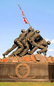
Other frequently visited sites near the cemetery are the U.S. Marine Corps War Memorial, commonly known as the "Iwo Jima Memorial", the U.S. Air Force Memorial, the Women in Military Service for America Memorial, the Netherlands Carillon and the U.S. Army's Fort Myer.
The Pentagon
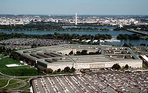
The Pentagon in Arlington is the headquarters of the United States Department of Defense. It was dedicated on January 15, 1943 and it is the world's largest office building. Although it is located in Arlington, the United States Postal Service requires that "Washington, D.C." be used as the place name in mail addressed to the six ZIP codes assigned to The Pentagon.[83]
The building is pentagon-shaped in plan and houses about 23,000 military and civilian employees and about 3,000 non-defense support personnel. It has five floors and each floor has five ring corridors. The Pentagon's principal law enforcement arm is the United States Pentagon Police, the agency that protects the Pentagon and various other DoD jurisdictions throughout the National Capital Region.
Built during the early years of World War II, it is still thought of as one of the most efficient office buildings in the world. It has 17.5 miles (28 km) of corridors, yet it takes only seven minutes or so to walk between any two points in the building.
It was built from 680,000 short tons (620,000 t) of sand and gravel dredged from the nearby Potomac River that were processed into 435,000 cubic yards (330,000 m³) of concrete and molded into the pentagon shape. Very little steel was used in its design due to the needs of the war effort.
The open-air central plaza in the Pentagon is the world's largest "no-salute, no-cover" area (where U.S. servicemembers need not wear hats nor salute). The snack bar in the center is informally known as the Ground Zero Cafe, a nickname originating during the Cold War when the Pentagon was targeted by Soviet nuclear missiles.
During World War II, the earliest portion of the Henry G. Shirley Memorial Highway was built in Arlington in conjunction with the parking and traffic plan for the Pentagon. This early freeway, opened in 1943, and completed to Woodbridge, Virginia in 1952, is now part of Interstate 395.
Transportation
Airports
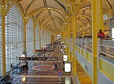
Located here is Ronald Reagan Washington National Airport (IATA: DCA, ICAO: KDCA, FAA LID: DCA), which provides North American air services to the Washington, D.C. area. In 2009, Condé Nast Traveler readers voted it the country's best airport.[84]
Nearby airports with international services include Washington Dulles International Airport (IATA: IAD, ICAO: KIAD, FAA LID: IAD) , located in Fairfax and Loudoun counties in Virginia, and Baltimore-Washington International Thurgood Marshall Airport (IATA: BWI, ICAO: KBWI, FAA LID: BWI) , located in unincorporated Anne Arundel County, Maryland.
Public transportation
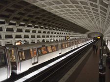
Arlington is served by the Orange, Blue and Yellow lines of the Washington Metro. Additionally, it is served by Virginia Railway Express (commuter rail), Metrobus (regional public bus), Fairfax Connector (regional public bus), Potomac and Rappahannock Transportation Commission (PRTC) (regional public bus), and a county public bus system, Arlington Transit (ART).
Rosslyn, Courthouse, and Ballston are accessible on Metro's Orange Line from east to west, as well as the Silver Line in coming years. Rosslyn, Pentagon City, and Crystal City are accessible on the Blue Line from north to south, with Pentagon City and Crystal City also utilizing the Yellow Line.
Taxis
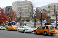
In 2007, the County Board authorized a new taxi company to operate exclusively with a hybrid electric fleet of 50 vehicles and also issued permits for existing companies to add 35 hybrids to their fleets. As operations began in 2008, EnvironCab became the first all-hybrid taxicab fleet in the U.S. and the company not only offsets the emissions generated by its fleet of hybrids, but also the equivalent emissions of 100 non-hybrid taxis in service in the Washington, D.C. metropolitan area.[85][86]
The green taxi expansion is part of a county campaign known as Fresh AIRE, or Arlington Initiative to Reduce Emissions, that aims to cut production of greenhouse gases from county buildings and vehicles by 10 percent by 2012.[85]
Roads
- Main articles: Streets and highways of Arlington County, Virginia and Arlington County, Virginia, street-naming system
The county maintains 376 miles (605 km) of roads.[87]
The street names in Arlington generally follow a unified countywide convention. The north / south streets are generally alphabetical, starting with one-syllable names, then two-, three- and four-syllable names for streets going north / south. (The "lowest" alphabetical street is Ball Street. The "highest" is Arizona.) Many east / west streets are numbered. Route 50 divides Arlington County. Streets are generally labeled North above Route 50, and South below. Arlington County is traversed by two interstate highways, Interstate 66 in the northern part of the county and Interstate 395 in the eastern part, both with high-occupancy vehicle lanes or restrictions. In addition, the county is served by a number of multi-lane urban arterial roads and the George Washington Memorial Parkway.
Bicycle paths
Arlington has 86 miles (138 km) of on-street and paved off-road bicycle trails.[88] Off-road trails travel along the Potomac River or its tributaries, abandoned railroad beds, or major highways. Many of the county's major streets designate bicycle lanes near their curbs or parking lanes. Green route signs help cyclists navigate the routes while yellow warning signs alert drivers to the many street crossings.
Several regional paved off-road trails originate in Arlington and extend well beyond its boundaries. The Washington & Old Dominion Railroad Trail (W&OD Trail) rail trail travels 45 miles (72 km) northwest from Shirlington through Falls Church, Vienna, Herndon, and Leesburg to the town of Purcellville in western Loudoun County, Virginia. The Mount Vernon Trail runs for 17 miles (27 km) along the Potomac, continuing through Alexandria to George Washington's plantation home in Fairfax County.
Smaller, intra-county trails connect the larger trials. In Arlington's southeast corner, immediately south of Ronald Reagan Washington National Airport, the Mount Vernon Trail meets the Four Mile Run Trail, which travels westward through Arlington in a stream valley, connecting to the W&OD. The hilly Custis Trail begins at the Mount Vernon Trail in Rosslyn and travels westward beside Interstate 66 to the W&OD. The Bluemont Junction Trail, another rail trail, travels between the W&OD Trail and the Custis Trail in Ballston.
A partially off-road bike route bisects the County while traveling westward from Arlington National Cemetery, the Iwo Jima Memorial and Rosslyn to Falls Church while travelling as a paved trail near or adjacent to Arlington Boulevard (U.S. Route 50) or within the boulevard's service road.
National protected areas
The following national protected areas are located in Arlington:
- Arlington House, The Robert E. Lee Memorial
- George Washington Memorial Parkway (part)
Education
Primary and secondary schools
Arlington County is served by the Arlington Public Schools system. The public high schools in Arlington County are Wakefield High School, Washington-Lee High School, Yorktown High School and the H-B Woodlawn program. Arlington County is also home to Bishop O'Connell, a Roman Catholic high school.
Arlington County spends about half of its revenue on education, making it one of the top ten per-pupil spenders in the nation (as of 2004, over $13,000, the second highest amount spent on education in the United States, behind New York City).
Through an agreement with Fairfax County Public Schools approved by the school board in 1999, up to 26 students residing in Arlington per grade level may be enrolled at the Thomas Jefferson High School for Science and Technology in Fairfax at a cost to Arlington of approximately $8000 per student. For the first time in 2006, more students (36) were offered admission in the selective high school than allowed by the previously established enrollment cap.[89]
Colleges and universities
Marymount University is the only university with its main campus located in Arlington. Founded in 1950 by the Religious of the Sacred Heart of Mary as Marymount College of Virginia located on North Glebe Road. The school has expanded into offering complete 4 year undergraduate degrees, graduate degrees and recently doctoral degrees in Fall 2004. The school expanded in the early 1990s and opened an additional campus in Ballston. They also have a Reston Center located in Reston, Virginia.
George Mason University operates an Arlington campus in the Virginia Square area between Clarendon and Ballston. The campus houses the School of Law, School of Public Policy and other programs. The University is constructing a new building, expected to open in 2010, to provide additional space for the School of Law and other graduate programs.
The Institute for the Psychological Sciences is a regionally accredited institution offering postgraduate programs in Psychology with a Roman Catholic perspective. Its campus is in the Crystal City neighborhood.
The John Leland Center for Theological Studies, a baptist institution composed of a graduate seminary and undergraduate school, has its main campus in the Clarendon neighborhood.
DeVry University operates a campus for undergraduate classes along with the Keller School of Management for its graduate classes, in Crystal City. The University established the campus in 2001.
University of Management and Technology is a distance learning university that is headquartered in Rosslyn.
The Art Institute of Washington, a local branch of The Art Institutes is located in the Ames Center across from the Rosslyn Metro Station.
Strayer University has a campus in Arlington as well as its corporate headquarters.
In addition, Argosy University, Banner College, Everest College, George Washington University, Georgetown University, Northern Virginia Community College, Troy University, the University of New Haven, the University of Oklahoma, and Westwood College all have campuses in Arlington.
Athletics
Interest in sports for youngsters outside the school has varied over the years. In 1974, for example, 1,650 youngsters were participating in soccer in a county-wide association.[90]
Sister cities
Arlington has five sister cities, as designated by Sister Cities International:
 Aachen, Germany
 Reims, France
 San Miguel, El Salvador
 Coyoacán, Mexico
 Ivano-Frankivsk, Ukraine
 Tangerang, Indonesia
Notables
- Robert E. Lee, Confederate General who lived at Arlington House
- George Washington Parke Custis, the step-grandson and adopted son of President George Washington
- David McDowell Brown, NASA Astronaut, died during Shuttle Columbia mission STS-107
- Sandra Bullock, movie actress
- Aldrich Hazen Ames[91]
- Major Nidal Malik Hasan, the sole suspect in the November 5, 2009 Fort Hood shootings. Born in Arlington.[92]
- Katie Couric, Journalist, CBS News Anchor, Interviewer
- Warren Beatty
- Shirley MacLaine
- Tom Dolan, Olympic Swimmer
- Patch Adams
- Zac Hanson
- Alexander Ovechkin and Mike Green, NHL player with the Washington Capitals who practice in Arlington
- Danny Ahn, musician
- Mikhail Kutzik and Natalia Pereverzeva - accused spies
See also
- Arlington Hall
- Arlington Independent Media
- List of federal agencies in Northern Virginia
- List of people from the Washington, D.C. metropolitan area
- Arlington County Sheriff's Office
- Arlington County Police Department
- Arlington County Fire Department
References
- ↑ 1.0 1.1 "Profile". http://www.arlingtonva.us/departments/CPHD/planning/data_maps/CPHDPlanningDataandMapsProfile.aspx?lnsLinkID=1150. Retrieved January 1, 2008.
- ↑ "National Association of Counties". http://www.naco.org/Content/NavigationMenu/About_Counties/County_Government/A_Brief_Overview_of_County_Government.htm. Retrieved September 1, 2008.
- ↑ Arlington, Virginia VA, profile (Arlington County)
- ↑ Woolsey, Matt (2008-01-22). "Real Estate: America's Richest Counties". Forbes.com. http://www.forbes.com/2008/01/22/counties-rich-income-forbeslife-cx_mw_0122realestate.html. Retrieved 2009-05-05.
- ↑ Some Cities Will Be Safer in a Recession
- ↑ "Best Places for the Rich and Single" Retrieved 2009-10-03.
- ↑ Best Cities for Families Retrieved 2010-06-19.
- ↑ United States Statutes At Large, 1st Congress, Session III, Chapter 18, pp. 214-215, March 3, 1791.
- ↑ Boundary markers of the Nation's Capital : a proposal for their preservation & protection : a National Capital Planning Commission Bicentennial report. National Capital Planning Commission, Washington, DC, 1976; for sale by the Superintendent of Documents, U.S. Government Printing Office
- ↑ Boundary Stones of the District of Columbia
- ↑ Sixth Congress, Session II, Chapter XV (An Act concerning the District of Columbia), Section 2 (Stat. II, Feb. 27, 1801) (United States Statutes at Large, Vol. II, p. 103); "Statutes at Large, 6th Congress, 2nd Session". A Century of Lawmaking for a New Nation: U.S. Congressional Documents and Debates, 1774 - 1875. Library of Congress. http://memory.loc.gov/cgi-bin/ampage?collId=llsl&fileName=002/llsl002.db&recNum=140. Retrieved 2008-07-10.
- ↑ "Frequently Asked Questions About Washington, D.C.". The Historical Society of Washington, D.C.. http://www.citymuseumdc.org/gettoknow/faq.asp. Retrieved August 30, 2006.
- ↑ "Alexandria's History". http://alexandriava.gov/city/about-alexandria/about.html#history. Retrieved August 30, 2006.
- ↑ "Historical Information". Arlington National Cemetery. http://www.arlingtoncemetery.org/historical_information/arlington_house.html. Retrieved 2008-05-20.
- ↑ Bradley E. Gernand. A Virginia Village Goes to War--Falls Church During the Civil War. Virginia Beach: The Donning Company, 2002. Page 23.
- ↑ Gernand, A Virginia Village Goes to War, pp. 23-25.
- ↑ Gernand, A Virginia Village Goes to War, pp. 73-74, 89.
- ↑ Gernand, A Virginia Village Goes to War, p. 91.
- ↑ Arlington Sun Gazette, October 15, 2009, "Arlington history", page 6, quoting from the Northern Virginia Sun
- ↑ "Fast Facts." US Airways. January 28, 1998. Retrieved on May 13, 2009.
- ↑ Gilbertson, Dawn. "US Airways pilots win union case." The Arizona Republic. May 13, 2009. Retrieved on May 13, 2009.
- ↑ John Townsend (2010-02-11). "Blizzard of 2010: Stranded motorists". Washington Post. http://www.washingtonpost.com/wp-dyn/content/discussion/2010/02/11/DI2010021102657.html.
- ↑ "Captured: A Snowy Week in the East". Denver Post. 2010-02-11. http://blogs.denverpost.com/captured/2010/02/11/a-snowy-week-in-the-east/.
- ↑ Snow removal ordinance
- ↑ "US Gazetteer files: 2000 and 1990". United States Census Bureau. 2005-05-03. http://www.census.gov/geo/www/gazetteer/gazette.html. Retrieved 2008-01-31.
- ↑ 26.0 26.1 [1]
- ↑ Arlington's Urban Villages
- ↑ "Find a County". National Association of Counties. http://www.naco.org/Template.cfm?Section=Find_a_County&Template=/cffiles/counties/usamap.cfm. Retrieved 2008-01-31.
- ↑ [2]
- ↑ [3]
- ↑ [4]
- ↑ [5]
- ↑ [6]
- ↑ [7]
- ↑ Planning Research and Analysis Team (PRAT)
- ↑ Development Reports and Statistics
- ↑ Arlington County Government Historic Preservation Program Official Arlington County Government Website. Retrieved on 2008-02-05.
- ↑ Arlington County Zoning Ordinance: Section 31.A. Historic Preservation Districts Official Arlington County Government Website. Retrieved on 2008-02-05.
- ↑ List of Arlington County Government Designated Local Historic Districts Official Arlington County Government Website. Retrieved on 2008-02-05.
- ↑ List of Arlington County Sites in the National Register of Historic Places Official Arlington County Government Website. Retrieved on 2008-02-05.
- ↑ Neighborhood Conservation Program Official Arlington County Government Website. Retrieved on 2008-02-05.
- ↑ Neighborhood Conservation Plans Official Arlington County Government Website. Retrieved on 2008-02-05.
- ↑ Arlington County Planning Research and Analysis Team
- ↑ "American FactFinder". United States Census Bureau. http://factfinder.census.gov. Retrieved 2008-01-31.
- ↑ "Arlington County, Virginia". US Census. 2009-10-23. http://quickfacts.census.gov/qfd/states/51/51013.html.
- ↑ Carol Morello; Dan Keating (2009-10-28). "Single living surges across D.C. region". Washington Post. Washington Post. pp. A20. http://www.washingtonpost.com/wp-dyn/content/article/2009/10/27/AR2009102702019.html.
- ↑ 47.0 47.1 Annie Gowen (2009-11-07). "Fresh faces, thick wallets". Washington Post. Washington Post. pp. B4. http://www.washingtonpost.com/wp-dyn/content/article/2009/11/06/AR2009110604170.html.
- ↑ Scott McCaffrey (2009-10-2009). "County's Registered Voters Top 130,000". Arlington Sun Gazette. pp. 5.
- ↑ Although Arlington CDP had a population of 135,449 in 1950, the Census did not treat Arlington as a CDP because in 1950 CDPs were assigned to rural areas only. They were first assigned to urban areas during the 1960 Census.
- ↑ FY 2009 County budget resolution
- ↑ "Contacting the Airports Authority." Metropolitan Washington Airports Authority. Retrieved on March 2, 2010.
- ↑ Carl M. Cannon (2009-11-04). "McDonnell, Republicans Sweep Virginia". Washington Post. Washington Post. pp. A1, A6. http://www.politicsdaily.com/2009/11/04/mcdonnell-republicans-sweep-virginia/.
- ↑ "Northern Virginia Voter Turnout". Falls Church News-Press. Falls Church News Press. 2009-11-05. pp. 5.
- ↑ Jay Fisette
- ↑ Fisette for Arlington
- ↑ Chris Zimmerman
- ↑ [8]
- ↑ [9]
- ↑ [>Barbara Favola
- ↑ Mary Margaret Whipple
- ↑ David Englin
- ↑ Patrick Hope
- ↑ Robert Brink
- ↑ Adam Ebbin
- ↑ School Board
- ↑ Frank O'Leary
- ↑ Richard "Dick" Trodden
- ↑ Beth Arthur
- ↑ Ingrid Morroy
- ↑ Hank Silverberg (2008-10-09). "Hundreds of thousands in region lack health insurance". WTOP FM Radio. WTOP FM Radio. http://www.wtop.com/?nid=720&sid=1493997.
- ↑ Fears, Darryl (27 April 2010). "Suburbs trail D.C. in fighting AIDS, study ssays". Washington, DC: Washington Post. pp. A5. http://www.washingtonpost.com/wp-dyn/content/article/2010/04/26/AR2010042604338.html.
- ↑ "Violent Crime Down 8.3 Percent". Arlington, Virginia: The Arlington Connection. April 14–20, 2010. pp. 5. http://www.co.arlington.va.us/departments/Communications/PressReleases/page75824.aspx.
- ↑ Arlington Unemployment Drops Below 4 Percent, Arlington Sun Gazette, December 4, 2009
- ↑ Northern Virginia jobless rate falls to 5%
- ↑ An Oasis of Stability Amid a Downturn
- ↑ County Profile
- ↑ Arlington Economic Development
- ↑ Arlington CDP, Virginia
- ↑ The highest was Loudon County, Virginia
- ↑ Scott McCaffrey (2009-11-05). "Arlington Unemployment Up Slightly, Still Lowest Statewide". Sun Gazette. Sun Gazette. pp. 4. http://www.sungazette.net/articles/2009/11/05/arlington/news/nw377.txt.
- ↑ O'Donohue, Julia (April 7–13, 2010). "Housing Market Looking Up". Arlington Connection (Melbourne, Florida: http://files.connectionnewspapers.com): pp. 2. http://files.connectionnewspapers.com/PDF/current/Arlington.pdf.
- ↑ Merle, Renae (15 April 2010). "Federal aid forestalls fraction of foreclosures". Washington, DC: Washington Post. pp. A16. http://www.washingtonpost.com/wp-dyn/content/article/2010/04/14/AR2010041404336.html.
- ↑ Facts & Figures: Zip Codes
- ↑ "2009 Business Travel Awards from Conde Nast Traveler" Retrieved 2009-10-27.
- ↑ 85.0 85.1 Downey, Kirstin (2007-09-07). "Arlinton County: Board Gives Go-Ahead to Eco-Friendly Taxicabs". The Washington Post. http://www.washingtonpost.com/wp-dyn/content/article/2007/09/19/AR2007091902438.html. Retrieved 2010-07-10.
- ↑ "All-Hybrid Taxi Fleet Debuts in Sunny Phoenix". GreenBiz. 2009-10-20. http://www.greenbiz.com/news/2009/10/20/all-hybrid-taxi-fleet-debuts-sunny-phoenix. Retrieved 2010-07-10.
- ↑ County website
- ↑ Arlington Country Environmental Services Official Arlington County Government Website. Retrieved on 2008-09-17
- ↑ "TJHSST Admissions Statistics for 2005-06" (PDF). http://www.fcps.k12.va.us/mediapub/pressrel/tjhsstadmisstats2005-06.pdf. Retrieved August 30, 2006.
- ↑ Arlington Sun Gazette, October 15, 2009, page 6, "Arlington history", quoting the Northern Virginia Sun
- ↑ A Spy's Story in a World Of Many-Sided Betrayal, The New York Times, by Tim Weiner, February 23, 1994 dated February 22, 1994, Washington
- ↑ McKinley, Jr., James C.; Dao, James (November 8, 2009). "Fort Hood Gunman Gave Signals Before His Rampage". The New York Times. http://www.nytimes.com/2009/11/09/us/09reconstruct.html. Retrieved November 9, 2009.
External links
- Official Site of Arlington County Government
- Arlington travel guide from Wikitravel
- Arlington's Urban Villages
- Arlington County on Facebook
- Arlington Historical Society
- Soil survey and climate summary
 |
Fairfax County | District of Columbia | |
|
| Fairfax County | District of Columbia | |||
| City of Falls Church | City of Alexandria |
|
|||||||||||
|
||||||||||||||||||||